

Bao'an West Line Park
Bao’an Highway Corridor Slow-moving Planning Project
Collaboration: Zhongdu Engineering Design
Client: Bao’an Urban Management Bureau
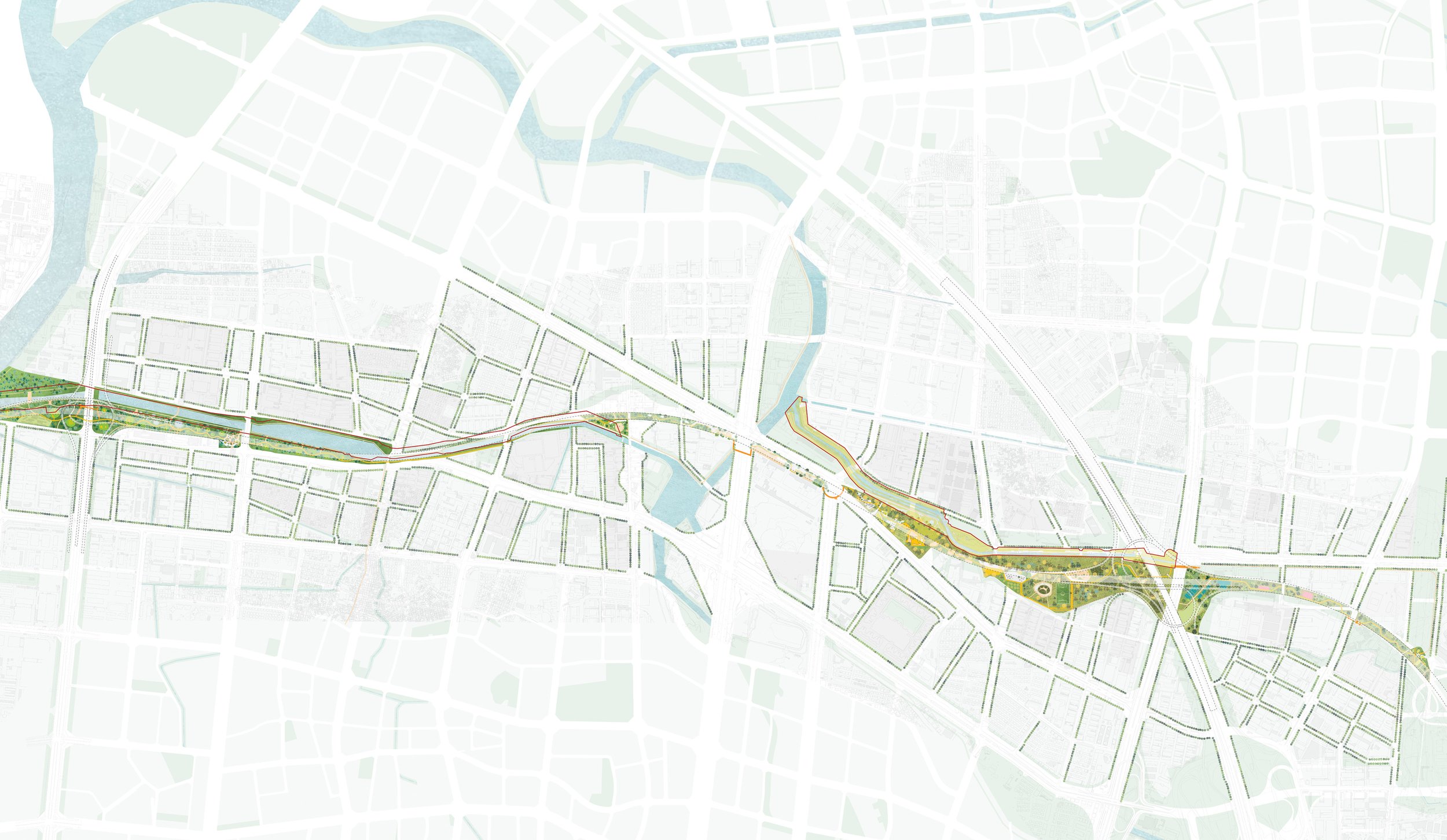
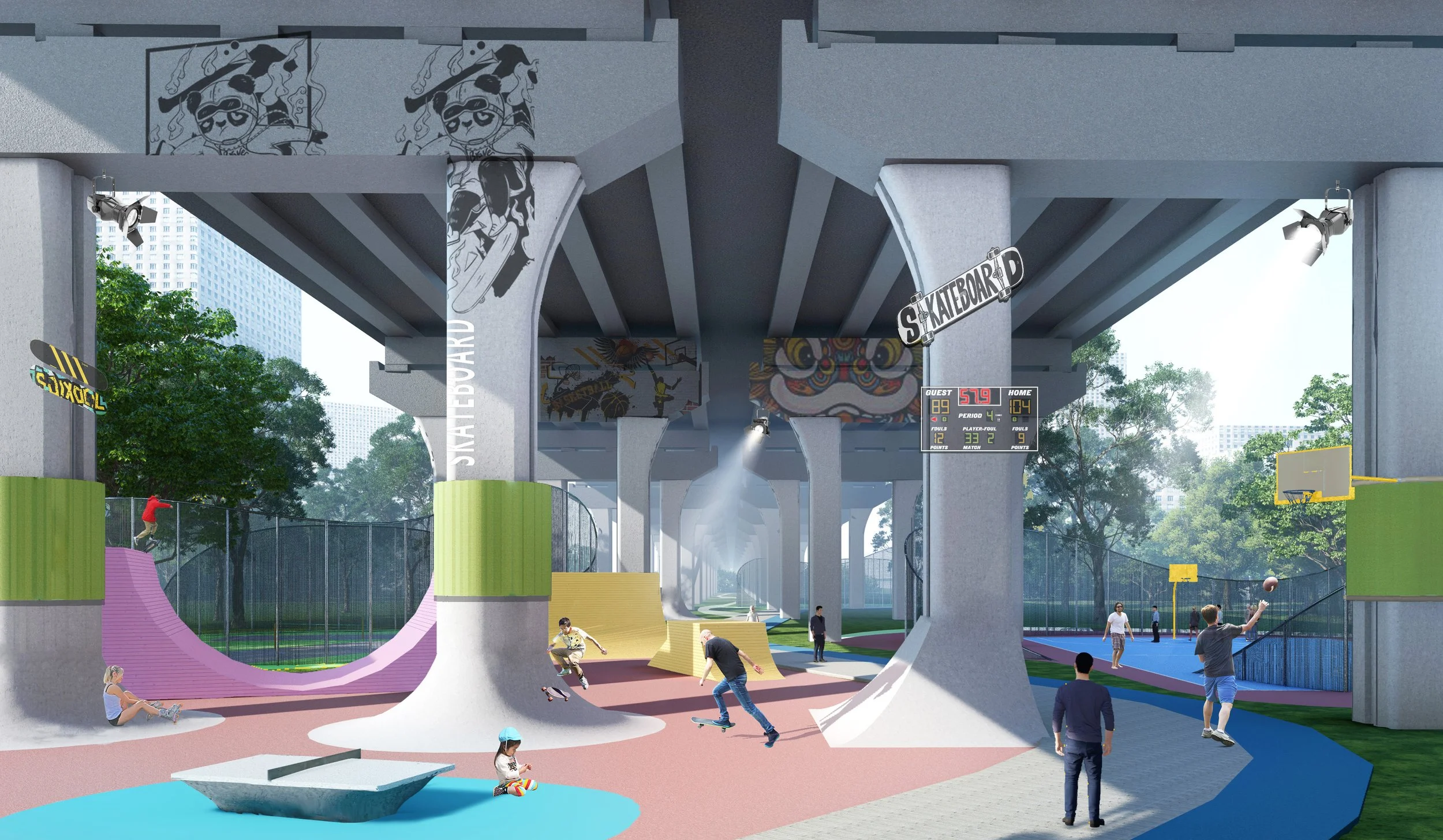
Base on the global trend of ecological and sustainable urban development, as an important corridor in the Shenzhen Mountain-Sea Linkage Plan, the space under the Bao’an Outer Ring Highway Bridge is about 8km long, all covered by elevated highway. The height is between 8-14 meters and width is about 35 meters.
The concept of the project “Mountain-sea Line” includes four layers:
Green Line - introduces four habitats, with wetland, meadow, orchard, and forest as the base, extending to a larger urban scale; integrating the greenway range and integrating into the regional water ecology
Accessible Line - create different roaming experiences. Breakpoint stitching, pedestrian bridge-cross-river bridge-stabilization treatment, etc
Dynamic Line - ecological leisure/urban public/community life/healthy sports. Enrich the theme experience and create community symbiosis
Cultural Line - Each zone creates a urban node and creates a public highland for Bao’an. Dissolve boundaries and form new urban cultural places


LAND-Baoan west line